roadtrip Switzerland
The beautiful Alps, beautiful clear blue lakes, beautiful villages, … Switzerland has it all!
In summer a real ‘walhalla’ for hikers, in winter a paradise for winter sports lovers.
We visited the northern and a small part of the middle part of Switzerland in a few days. A fantastic road trip that we are happy to share with you.
day 1
The day before, after work, we drove on to our first place to sleep. We woke up near Rhine falls.
Since we were exploring early in the morning, we had the place almost to ourselves. The Rhine falls is very impressive. It is the most powerful waterfall in Europe.
Address of the sleepspot: Lauferstrasse, 8248 Laufen-Uhwiesen, Zwitserland

Afterwards we drove to Mount Rigi to hike a panoramic trail.
It was a beautiful, tough hike but the views rewarded making the many altimeters.
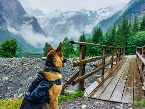
Tip for walking with your dog: Take a good look at which walking route you take to the top. We have (unknowingly) chosen a walking route with many stairs, this was not dog friendly!
General tip: You can also take the cable car to the top if you want, in our opinion you pay a lot of money for this and if you actually hike to the summit the view is way more rewarding


day 2
We started the day with canoeing on Lake Luzern. This was magical! We have an inflatable canoe, so we can easily choose where we want to peddle if it is made accessible. If you also want to canoe here, you may have to look for local rental companies.
The coordinates of the sleepspot are: 46.993272,8.513933

We continue our way towards Engelberg. This is a remote ski area where you can also make beautiful walks and bike tours in the summer. You can find 360 km of hiking trails here. It’s really worth it.
We were here on a very rainy day but that didn’t make it any less beautiful.
If you walk around here you will see a lot of waterfalls. Here too you can take a cable car to a viewpoint, we have chosen not to do this because of the cost.

day 3
Story time: The goal of the day was to reach the Triftbrücke on foot. This is a suspension bridge above the glacial lake called the ’triftsee’. Unfortunately we never made it to the top.
You can reach the triftbrücke in two different ways.
1. Either you take the gondala up to the start of the hike into the mountains, so you don’t have to do a lot of altimeters on foot.
2. Either you choose to do the part you would do with the gondala on foot.
We chose option 2.
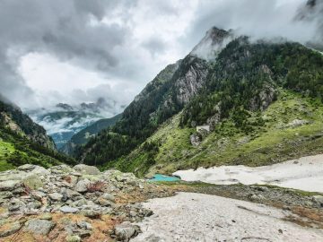
We hiked a trail marked ‘medium difficulty’ towards the top from our parking lot. It soon became clear that we were making a lot of altimeters on the small, narrow hiking trail along the mountainside. It was a tough and dangerous climb. When we got to the height of the gondala platform, it started to rain heavily. We decided to walk towards the Triftbrücke. When we were only a few kilometers from the bridge we heared thunder and saw lightning. That was when we decided to walk back to the gondola. We were lucky because we were the last people to go downhill with the gondala. The gondola decided to not go up anymore due to dangerous weather conditions leaving many people stranded at the top for hours.
Unfortunately I can’t show pictures of the Triftbrücke in this blog.
But these situations are also part of travelling, we have already been able to discover so much that we will certainly take this bad luck and just return another time


day 4
This day was also all about hiking for us. We made a tough hike (8km, 770 altimeters) with panoramic views to Harder Kulm. This very steep trail starts at the Interlaken Harderbahn station. It is a tough walk and you don’t see beautiful views at all times. Much of the walk is through wooded areas. The path is very well accessible with a dog. At the top you will have an impressive view of the Eiger and the Jungfrau. You also have a restaurant at the top, but it is very expensive there.
The interlaken region is beautiful. Below in the link you can find the walking route of the hike we made. We think this is highly recommended!
https://www.alltrails.com/explore/trail/switzerland/bern/harderkulm-trail?mobileMap=false&ref=sidebar-static-map

day 5
On our last day in beautiful Switzerland we visited Oeschinensee.
Just like with the other hikes we made this holiday, you have two options to get to the Oeschinensee: on foot or by gondala. Just like the previous times, we opted for the hard (but rewarding)way, on foot. From the parking (paying) we took route no. 2 (Kadersteg-Oeschinen). It takes about 1 hour to get to Lake Oeschinen. The walk started with a steep climb. The sun was also directly on the side of the mountain where we were hiking. You cannot find any shadow spots here until you arrive at the flatter part of the trail. The walking path was very passable with a dog.
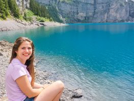
After our very manageable walk we arrived at the lake. The beautiful clear blue water of the lake contrasts very nicely with the opposite mountains. So breathtaking! In the summer you can also swim in the icy water of the lake. It can also be very busy here in summer periods, unfortunately it is a tourist attraction. You can also find a cafe and you can rent boats here.
General tip: If we had been able to spend more time at the Oeschinensee, we would have liked to walk the ‘heuberg panorama hike trail’. It is a 15 km walk. Unfortunately we didn’t have enough time for this anymore and we had to leave for home.


general tips voor Switzerland
– Switzerland is not part of the EU, using your regular SMS and internet rates are often very expensive. On the first day in Switzerland, we bought a SIM card from Swisscom (a local provider) with a subscription of a few days with unlimited data. This was a cheaper alternative for us.
– To be allowed to drive around (on highways) in Switzerland with your car/camper, you have to buy a mandatory vignette. If you buy this online in advance, it is cheaper than at a gas station along the road.
– If you would like to visit a mountain top using a gondola, buy your tickets online in advance.
– Switzerland is generally an expensive country for tourists. Going out, drinking,.. is often very expensive. We have avoided this to save costs.


thortravels.be